Correct capitalisation helps people identify topographic and geographic terms in your content. Refer to landmark features, regions and compass points correctly.
Write official names with capitals
Check official place names and style them correctly. You can check the spelling of an official name using the Australian Place Names dataset.
The full names of mountains, rivers, valleys, bays, islands and other features always take initial capitals.
Example
- the Hunter Valley
- the Three Sisters
- the Paroo River
Some shortened forms that are popular names or nicknames are also capitalised.
Example
- The Snowy Mountains can also be called the ‘Snowies’.
- The northern part of the Northern Territory is known as the ‘Top End’.
Write generic terms in lower case
In most cases, don’t use initial capitals when you use the name as a generic term.
Example
I paddled a kayak 200 km down the Balonne River. The river was in flood for some of the trip.
When using the same generic term for 2 or more names in the same sentence, use lower case for the generic term.
Example
The Barossa and Hunter valleys are important winemaking areas. [The word ‘valley’ refers to both valleys. It’s used generically and does not take an initial capital.]
The Barossa Valley is in South Australia and the Hunter Valley is in New South Wales. [The word ‘valley’ is part of the name of each valley and so is capitalised.]
Keep the initial capital when the general term is a well-recognised abbreviation and works as a proper name.
Example
The Great Barrier Reef is also called ‘the Reef’.
The Gulf of Carpentaria is also known as ‘the Gulf’.
Don’t use an initial capital if you’re using the noun in a generic sense.
Example
The Amazon rainforest is vital to the health of our planet. [The ‘Amazon rainforest’ is not the official name of the region. The word ‘rainforest’ is generic and doesn’t need an initial capital.]
Limit abbreviated names
‘Mt’ is a common and easily recognisable abbreviation for mountains. Use the abbreviation consistently in content and use initial capitals.
Example
Mt Tennent is part of Namadgi National Park.
Spell out the names of other topographic features if you can. Use the abbreviated form only where there’s limited space or a lot of repetition, such as in tables and maps.
Use Geoscience Australia’s authorised abbreviations.
Example
- C Tribulation [Cape]
- L Burley Griffin [Lake]
- Murray R [River]
- Green Is [Island]
- Keppel Bay Is [Islands]
Don’t use an apostrophe for possessive names
Don’t use an apostrophe for topographic terms involving possessives. Official place names are not possessive and do not usually include punctuation.
Refer to related guidance on Australian place names.
Correct
- Careys Peak
Incorrect
- Carey’s Peak
Spell the plural form correctly
The plural of any topographic name is formed simply by adding ‘s’ or ‘es’.
Example
There are 4 Mount Wellingtons in Australia but only one Mount Coot-tha.
- There are 3 Mount Jameses in Australia. There is one in Queensland, one in South Australia and one in Western Australia.
Write compass points in lower case
In text, write the points of a compass in lower case. Use hyphens for points such as ‘north-east’.
Example
- south
- north-east
- west-north-west
- A north-westerly wind was blowing the fire towards the town.
- The car was 30 degrees east of where it should have been.
- A cool change was coming from the south.
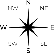
You can use initialisms in tables, illustrations and some specialist works. Always use capital letters with no full stops or hyphens.
Example
Release notes
The digital edition consolidates and expands information about topographic terms. It relates to guidance on Australian place names.
The sixth edition provided brief information under ‘geographic features’ and ‘compass points’.
The Content Guide did not have specific details on topographic terms.
About this page
References
Data.gov.au (n.d.) Datasets, data.gov.au, accessed 10 June 2020.
Geoscience Australia (2012) ‘Section 2: National topographic map series (NTMS) and general reference map specifications’, Geoscience Australia topographic data and map specifications, Geoscience Australia website, accessed 10 June 2020.
Intergovernmental Committee on Surveying and Mapping (ICSM) (n.d.) Permanent Committee on Topographic Information, ICSM website, accessed 10 June 2020.
ICSM (n.d.) Place names: foundation spatial data, ICSM website, accessed 10 June 2020.
Permanent Committee on Place Names (2016) Principles for the consistent use of place names: includes principles for the use of Aboriginal and Torres Strait Islander place names and dual naming depiction principles, Intergovernmental Committee on Surveying and Mapping, accessed 29 May 2020.
Last updated
This page was updated Wednesday 4 January 2023.


